World
UN approves resolution to change world map representation
The UN General Assembly has approved a resolution to replace the Mercator projection, promoting a more accurate representation of Africa's size and other continents.
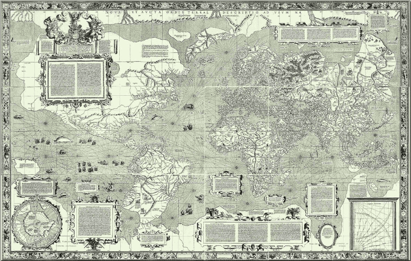

The United Nations General Assembly approved, on Friday, a resolution that changes the way world maps are represented, aiming to correct existing distortions. The proposal was presented by Togo and received support from the African Union (AU).
According to the resolution, current maps tend to show incorrect dimensions, making continents like Africa appear smaller than they really are. For instance, in traditional maps, Africa and Greenland appear to be of similar sizes, when in reality, the African continent is approximately fourteen times larger than the island of Greenland.
The new approach suggests abandoning the Mercator projection, a practice that has been widely used but results in significant dimensional distortions in some areas. The resolution was approved with 164 votes in favor, one against, from the United States, and six abstentions, as reported.
The approval of the resolution is part of a broader movement to recognize and correct geographic representation, highlighting the importance of accurate visualization of world regions. The support from the African Union underscores the continent's commitment to promoting a fair and realistic image of its dimensions.
This change in cartographic representation is seen as an important step toward correcting misconceptions that have a significant impact on how Africans and other regions are viewed in the world. The idea of correcting maps to more accurately reflect geographical reality has gained relevance in recent years, particularly in educational and cultural contexts.
This initiative, in addition to providing a more appropriate representation, will also be an important topic for discussion and reflection in future assemblies and international conferences on cartography and geopolitics.